Map
The map view provides an ortographic overview of your drones and other objects over the selected base map layer or map tile source.
Zoom, pan and rotation
The base map can be zoomed, panned and rotated flexibly with the tools available at its top left corner or with keyboard shortkeys and mouse moves. A Fit all drones button is also there to focus the view on all your drones.
Layers
Objects on the map appear in separate layers in order, such as Base map, UAVs, Features, Home location etc. The content, order and visibility of layers and thus objects associated with the layers can be altered on the Layers panel.
Selection and object actions
Different objects are associated with different actions that can be performed in the map view. To work with a given object, first you need to select it. A right click after object selection brings up a context menu that shows most of the actions provided for the given object.
| Selection of objects is global. If you select something (or more things) in one panel, the same selection will apply in the rest of the panels as well. |
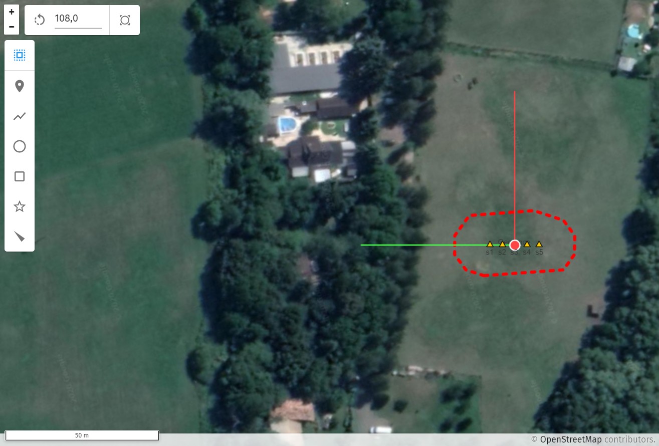
Flat Earth coordinate system
To ease navigation on the map, a flat Earth coordinate system can be defined with a custom map origin and direction. You can change the origin with a right click and selecting "Set map origin here" from the context menu. Alternatively, you can explicitely set map origin and flat Earth coordinate system orientation from the DISPLAY page of the Preferences widget (top right on the header or File→Settings from the menu).
| Map rotation and coordinate system orientation are independent things but it is advised to set them to the same value not to get confused. Start with setting map rotation so that you see what should be the preferred direction of "front". If you are satisfied, set coordinate system orientation to this value as well. |
Map origin is depicted on the map as a red dot with a red line pointing towards the x, and a green line pointing towards the y axis of the flat Earth coordinate system.
Measurements with the cursor
If you move the cursor over the map, a text box appears on the bottom right corner of the map showing the followings:
-
cursor position in geodetic coordinates (latitude, longitude)
-
cursor position in the defined flat Earth coordinate system
-
cursor distance and angle from map origin
| You can copy the actual cursor coordinates to the clipboard with Ctrl-Shift-C on Linux and Windows, or with ⌘-Shift-C on macOS. |