Data types used in messages
This section describes the complex data types and structures that are used in Flockwave messages. These data types will be referenced later from the Known message types section.
Timestamps
Timestamps MUST always be expressed as the number of milliseconds elapsed since the Unix epoch (1970-01-01 00:00:00 UTC). Note that this means that timestamps expressed in local time MUST be converted to UTC before expressing them as milliseconds.
Dates and times as strings
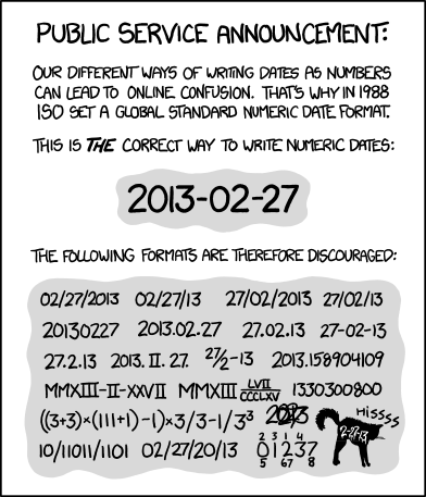
Dates, times and durations MUST always be expressed in UTC using an appropriate ISO 8601 format (see also RFC 3339, especially section 5.6 if you don’t like paywalls). Unless stated otherwise, the following formats should be used:
-
Dates should be expressed as YYYY-MM-DD (ISO 8601 extended format).
-
Times should be expressed as HH:mm:ss.sss (ISO 8601 extended format). The millisecond part may be omitted if not relevant.
-
Dates and times should be expressed as the date, followed by a literal
T, followed by the time, followed byZ, where theTis the standard ISO 8601 separator between dates and times, andZis the ISO 8601 marker for UTC (Zulu time).
Angles
Angles are always expressed in degrees because radians are for mathematicians. Depending on the context, angles may either be expressed in the half-open interval [0, 360), or in the half-open interval [-180, 180) or [-90, 90). For instance, latitudes, longitudes, roll and pitch are naturally expressed in an interval centered around zero, while heading and yaw information is typically presented as a non-negative number. When in doubt, look at the formal JSON schema specification for the allowed range of an angle.
| Even though it is common in aviation to indicate 360 degrees instead of zero degree, we always transmit zero degree instead of 360 degrees in messages because it comes naturally from the way computers handle modulo arithmetics. The user interface may still opt to present zero degree as 360 degrees if the user prefers that. |
However, when encoding an angle, it is first quantized in 1/10th of degrees and then encoded as a signed or unsigned integer in order to avoid floating point related inaccuracies and the accumulation of quantization errors (see discussion about floating-point inacccuracies). Therefore, the typical range of angles is [0, 3600) or [-1800, 1800), both of which are well versed to fit in a 16-bit integer.
Byte arrays
The JSON format does not support the transmission of raw byte arrays directly since the JSON string type is a sequence of Unicode characters and not a sequence of raw bytes. When a raw byte array has to be transmitted in JSON, the typical solution is to send a base64-encoded representation as a string (see RFC4648). This representation is approximately 33% longer than the corresponding raw byte array, but is still much shorter than the representation of the byte array as a JSON array of integers.
Temperatures
Temperatures are always expressed in kelvin because we do not want to take sides in the Celsius vs Fahrenheit debate. However, when encoding a temperature, it is first quantized in 1/10th of degrees kelvin and then encoded as an unsigned integer in order to avoid floating point related inaccuracies (see discussion about floating-point inacccuracies).
AntennaInformation
The AntennaInformation object holds information about the current RTK antenna.
Fields
| Name | Required? | Type | Description |
|---|---|---|---|
stationId |
no |
integer |
The station ID of the antenna, or null if not known |
descriptor |
no |
string |
The antenna descriptor, or null if not known |
serialNumber |
no |
string |
The serial number of the antenna, or null if not known |
position |
no |
The position of the RTK antenna, in GPS coordinates, or null if not known |
|
positionECEF |
no |
The position of the RTK antenna, in ECEF coordinates, or null if not known |
Example
{
    "stationId": "100",
    "descriptor": "ADVNULLANTENNA",
    "serialNumber": "12345678",
    "position": [519976597, -7406863, 93765],
    "positionECEF": [4120339623, 1418747456, 4641838123]
}
Attitude
An Attitude object describes the orientation of a UAV using the
standard roll, pitch and yaw angles. See the section about
angles for more information about how the angles are
expressed.
The object is stored as a list with three mandatory items.
Items
| Index | Required? | Type | Description |
|---|---|---|---|
0 |
yes |
the roll angle in 1/10th of degrees, in the range [-1800, 1800) |
|
1 |
yes |
the pitch angle in 1/10th of degrees, in the range [-1800, 1800) |
|
2 |
yes |
the yaw angle in 1/10th of degrees, in the range [0, 3600) |
Example
[0, 0, 900]AuthorizationScope
An AuthorizationScope object specifies the scope of the authorization to
start a drone show. This type should be interpreted in conjunction with the
StartConditions object.
The scope may be one of the following values:
none-
The show is not authorized to start.
live-
The show is authorized to start in a live setting, with all safety features enabled.
rehearsal-
The show is authorized to start in a rehearsal setting, with some or all of the safety features disabled for testing purposes. This should be used only if the flight takes place in a controlled environment, far from the audience.
lights-
The show is authorized to start with lights only; the UAVs participating in the show are not allowed to start their motors.
Earlier versions of this specification did not contain the AuthorizationScope
enum and StartConditions did not contain a field of this
type either. For sake of backwards compatibility, the authorizationScope field
in StartConditions is therefore optional. When it is not
provided, its value is assumed to be none if the authorization is not granted
and live if the authorization is granted.
BatteryInfo
A BatteryInfo object holds information about the state of an on-board
battery on a UAV.
The object is stored as a list with one mandatory and two optional items.
Items
| Index | Required? | Type | Description |
|---|---|---|---|
0 |
yes |
integer |
the battery voltage in one tenths of volts; zero if unknown |
1 |
no |
integer |
the state-of-charge of the battery, expressed as a percentage in the range [0, 100]; omitted or negative if unknown |
2 |
no |
boolean |
whether the battery is charging; defaults to false if omitted |
Example
[124, 100, false]BeaconBasicProperties
Monolithic object containing basic information about a single beacon that is unlikely to change over time.
Fields
| Name | Required? | Type | Description |
|---|---|---|---|
id |
yes |
string |
The unique identifier of the beacon |
name |
yes |
string |
The human-readable name of the beacon |
Example
{
    "id": "base",
    "name": "Main base"
}
BeaconStatusInfo
Monolithic object containing general status information about a single beacon.
Fields
| Name | Required? | Type | Description |
|---|---|---|---|
id |
yes |
string |
The unique identifier of the beacon |
position |
no |
The position of the beacon |
|
heading |
no |
The heading of the UAV, i.e. the direction the UAV is pointing, projected to the local tangent plane, if known. |
|
active |
no |
boolean |
Whether the beacon is active (operational). May be omitted for passive beacons or points of interest. |
timestamp |
yes |
Time when the last status update was received from the beacon |
Example
{
    "id": "base",
    "position": [519976597, -7406863, 93765],
    "timestamp": 1449562661000,
    "heading": 290,
    "active": true
}
ChannelOperation
Enumeration type that describes the possible operations that may be performed on a channel of a device (real or virtual) on a UAV. See Objects, devices and channels for more information. Currently the following values are defined:
read-
Represents the act of reading the current value of the channel.
write-
Represents the act of writing a new value to the channel.
ChannelType
Enumeration type that describes the possible types of channels of a device (real or virtual) on a UAV. See UAV devices and channels for more information. Currently the following values are defined:
audio-
A channel that provides a URL to an audio stream.
boolean-
A channel that provides a single Boolean value
bytes-
A channel that provides an array of raw bytes.
color-
A channel that provides a color in 8-bit RGB, RGBA or RGBW format. The color is typically expressed as an array of three or four bytes, each byte ranging from 0 to 255.
duration-
A channel that provides the duration of a time window, expressed as the number of seconds elapsed since the start of the time window. Fractional seconds are allowed.
number-
A channel that provides a single double-precision floating-point number.
object-
A channel that provides a complex JSON object.
string-
A channel that provides a UTF-8 encoded string.
time-
A channel that provides a time instant, expressed as the number of seconds elapsed since the UNIX epoch in UTC. Fractional seconds are allowed.
video-
A channel that provides a URL to a video stream.
ClockEpoch
A ClockEpoch object describes the epoch of a clock or timer that the
Flockwave server manages. It is either
a datetime string or one of the
following string values:
unix-
The UNIX epoch, i.e. midnight on 1 Jan 1970 UTC.
ClockInfo
A ClockInfo object describes the current state of a clock or timer
that the Flockwave server manages (e.g., a clock that reports the local
time, the GPS time or a MIDI timecode coming from an external MIDI
device connected to the server).
Fields
| Name | Required? | Type | Description |
|---|---|---|---|
id |
yes |
string |
the unique identifier of the clock |
epoch |
no |
the epoch from which the current timestamp of the clock is to be measured, if that makes sense for the clock. When the epoch is omitted, the clock is assumed to be ticking since an unspecified instant in the past. |
|
retrievedAt |
yes |
the time according to the internal clock server when the state of the clock was retrieved. If the internal clock of the server and the client is synchronized, this can be used by the client to compensate for the time it takes for the server to transmit the clock status message to the client. |
|
running |
yes |
boolean |
whether the clock is running at the moment |
ticksPerSecond |
no |
float |
the number of clock ticks per second. Must be larger than zero. When omitted, it is assumed to be equal to 1. |
ticks |
yes |
float |
the number of ticks that have elapsed on the clock |
Example
{
    "id": "mtc",
    "ticks": 4221,
    "retrievedAt": 1462890801000,
    "ticksPerSecond": 30,
    "running": true
}
ColorRGB565
A ColorRGB565 object is essentially a single integer in the range 0 to 65535
such that the most significant 5 bits encode the red component of an RGB color,
the least significant 5 bits encode the blue component, and the remaining 6
bits in the middle encode the green component. This data type is used when some
color information has to be transmitted in a way that does not occupy too much
space in the message, assuming that the exact color is not too important as
there is some quantization error when converting a 24-bit RGB color into
RGB565 representation.
CommandExecutionStatus
A CommandExecutionStatus object describes the execution status of a
command that was relayed from a client to a UAV by the server.
Fields
| Name | Required? | Type | Description |
|---|---|---|---|
sent |
yes |
time when the command request was sent to the UAV |
|
acknowledged |
no |
time when the UAV acknowledged the receipt of the request (explicitly or implicitly, i.e. by sending a status update or a response) |
|
updated |
no |
time when the UAV updated the progress of the request (explicitly or implicitly, i.e. by sending the completed response) |
|
finished |
no |
time when the final response was fully received by the server |
|
progress |
no |
float |
the progress of the execution of the command, expressed as an integer value between 0 and 100 (inclusive) |
status |
no |
string |
optional status text message |
Example
{
    "sent": 1459670842000,
    "acknowledged": 1459670842471,
    "updated": 1459670842811,
    "progress": 80,
    "status": "Almost ready :)"
}
CommandResponse
A CommandResponse object stores the response given by a particular UAV
to a command sent to it using an OBJ-CMD request, along with a type
annotation that tells the receiver how the response should be
interpreted.
Currently the protocol defines the following response types:
plain-
Plain text response that should be formatted on the receiver side as is. The receiver side is allowed to use a variable-width font and it can also perform additional formatting or word wrapping on the text if needed.
preformatted-
Preformatted response that should be printed on the receiver end with a fixed-width font. Newlines and tabulation should also be preserved on the receiver end if possible.
markdown-
Markdown-formatted text response that should be interpreted by a Markdown processor before it is displayed to the user.
Additional response types may be defined by the user as needed.
Example
{
    "type": "markdown",
    "data": "# Heading\n\nHello world!"
}
ConnectionInfo
A ConnectionInfo object describes the purpose and current state of a
connection that the Flockwave server manages (e.g., a radio link or a
DGPS stream).
Fields
| Name | Required? | Type | Description |
|---|---|---|---|
id |
yes |
string |
the unique identifier of the connection |
purpose |
yes |
the purpose of the connection (i.e. what sort of data it provides) |
|
description |
no |
string |
human-readable description of the connection |
status |
yes |
the current status of the connection |
|
timestamp |
no |
time when the last packet was received from the connection, or if it is not available, the time when the connection changed status the last time |
Example
{
    "id": "xbee",
    "purpose": "uavRadioLink",
    "description": "Upstream XBee radio link",
    "status": "connected",
    "timestamp": 1449562061000
}
ConnectionPurpose
Enumeration type that describes the purpose of a connection. Currently the following values are defined:
debug-
A connection that is meant for debugging purposes only.
dgps-
A connection whose purpose is to receive DGPS or RTK correction packets from an external stream (e.g., an NTRIP data source or a serial link to an RTK base station).
dock-
A connection that provides information about the status of a docking station.
gps-
A connection that receives data from a GPS device.
mocap-
A connection to a motion capture system.
time-
A connection whose purpose is to connect to a service or device that provides time-related information. Examples are connections to an NTP server or a MIDI timecode provider.
uavRadioLink-
A connection whose purpose is to receive status information from UAVs and/or send commands to them.
other-
A connection whose purpose does not fit into the above categories. It is advised to use a human-readable description for these connections.
ConnectionStatus
Enumeration type that describes the possible states of a connection. A connection may be in exactly one of the following five states at any time:
disconnected-
The connection is not alive and no connection attempt is currently in progress.
connecting-
The connection is not alive yet, but a connection or reconnection attempt is currently in progress.
connected-
The connection is alive.
disconnecting-
The connection is not alive any more, but it has not been properly shut down yet.
unknown-
The status of the connection is unknown (typically because we have received no status information from the connection yet).
The value of a field of type ConnectionStatus is always a string with
one of the five values above.
DeviceClass
Enumeration type that describes the possible classes (i.e. types) of devices in a device tree. Device classes may be used by user interfaces talking to a Flockwave server to provide some feedback to the user about the type of a device (e.g., it could show batteries with a different icon). Currently the following values are registered:
accelerometer-
The device is an accelerometer.
actuator-
The device is a generic actuator that cannot be categorised more precisely into any of the other classes.
altimeter-
The device is an altimeter (e.g., pressure sensor, radar altimeter, sonic altimeter).
battery-
The device is a battery.
camera-
The device is a camera (consumer-grade, infrared, security camera or anything else).
cpu-
The device is the CPU on the UAV (or on its companion computer).
cpuCore-
The device is one particular CPU core of the CPU of a UAV.
gps-
The device is a GPS receiver.
group-
The device represents a logical grouping of other devices. For instance, the rotors of a UAV may be grouped in a
rotorgroup. gyroscope-
The device is a gyroscope.
led-
The device is a single LED or a LED strip.
magnetometer-
The device is a magnetometer.
microphone-
The device is a microphone.
misc-
The device does not fall into any of the predefined device classes.
pyro-
The device is a pyrotechnic device (e.g., firework launcher board).
radio-
The device is a radio receiver or transmitter (e.g., an XBee radio).
rc-
The device is an RC receiver.
rotor-
The device is a rotor.
sensor-
The device is a generic sensor that cannot be categorised more precisely into any of the other classes.
speaker-
The device is a speaker.
DeviceTreeNode
This type represents a single node of the device tree. The node may represent a UAV or any other top-level object that has a unique ID, an onboard (real or virtual) device of an object, or a channel of a device. (See Objects, devices and channels for more details).
Fields
| Name | Required? | Type | Description |
|---|---|---|---|
type |
yes |
The type of the node |
|
subType |
no |
The type of the channel if the node is a channel node. This field is required for channel nodes and forbidden for other types of nodes. |
|
class |
no |
The type of the device that this node represents. This field is optional for device nodes and forbidden for other types of nodes. Its value may be used by Flockwave clients to represent the device in a different way on the UI or to hide certain types of devices. |
|
children |
no |
object of |
Object mapping names of child nodes to their descriptions |
operations |
no |
list of |
The list of operations supported by the channel. This field is required for channel nodes and forbidden for other types of nodes. |
unit |
no |
string |
The unit in which the value of the channel is represented. This field is optional for channel nodes (typically makes sense for numeric channels) and forbidden for other types of nodes. |
DeviceTreeNodeType
Enumeration type that describes the type of a device tree node (see
DeviceTreeNode. Currently the following values
are defined:
root-
This is the root node of the device tree. The node has no parent by definition. The children of the root node must be nodes of type
object. object-
This is a tree node that represents an object that is identified by its ID in the server. The parent of an
objectnode is always arootnode. The children of the object nodes must be nodes of typedevice. device-
This is a tree node that represents a device of an object, or a sub-device of another device. The parent of a
devicenode is either auavnode or anotherdevicenode. channel-
This is a tree node that represents a channel of a device. The parent of a
channelnode is always adevicenode.
DockStatusInfo
Monolithic object containing general status information about a single docking station.
Fields
| Name | Required? | Type | Description |
|---|---|---|---|
id |
yes |
string |
The unique identifier of the docking station |
position |
no |
The position of the docking station |
|
timestamp |
yes |
Time when the last status update was received from the docking station |
Example
{
    "id": "base",
    "position": [519976597, -7406863, 93765],
    "timestamp": 1449562661000
}
DroneLightsConfiguration
LED light related configuration object for drone shows. The object is used by the
SHOW-LIGHTS and the SHOW-SETLIGHTS commands to get or set the configuration
for the LED lights on drones.
Fields
| Name | Required? | Type | Description |
|---|---|---|---|
effect |
no |
string |
Type of the light effect. Can be either |
color |
no |
list of integers |
Color of the light effect in RGB notations. Values in the array must be between 0 and 255, inclusive. |
Example
{
    "effect": "solid",
    "color": [0, 18, 255],
}
DroneShowConfiguration
Configuration object for the drone show. It is used by the SHOW-CFG and
the SHOW-SETCFG commands to get or set the configuration for the drone show.
Fields
| Name | Required? | Type | Description |
|---|---|---|---|
start |
yes |
Object that contains the conditions regarding the start of the show |
|
mapping |
no |
list of strings |
Mapping of show-specific indices to the corresponding UAV IDs, if known. Not mandatory. |
duration |
no |
float |
The total duration of the show, in seconds. Not mandatory. |
Example
{
    "start": {
        "authorized": false,
        "time": 1581881192,
        "method": "auto",
        "uavIds": ["01", "42"]
    },
    "mapping": ["01", "02", null, "05", "42"],
    "duration": 294
}
ECEFCoordinate
This type represents a coordinate given by a GPS in the Earth-centered, Earth-fixed coordinate frame, where:
-
The origin is the center of mass of the Earth.
-
The X axis is in the plane of the equator, passing through the origin and extending from 180° longitude (negative) to the prime meridian (positive);
-
The Y axis is also in the plane of the equator, passing through extending from 90°W longitude (negative) to 90°E longitude (positive)
-
The Z axis is the line between the North and South Poles, with positive values increasing northward.
All three coordinates (X, Y, and Z) are stored in millimeters.
The object is stored as a list with three items.
Items
| Index | Required? | Type | Description |
|---|---|---|---|
0 |
yes |
float |
The |
1 |
yes |
float |
The |
2 |
yes |
float |
The |
Example
[4120339, 1418747, 4641838]ErrorList
This type is simply an array of numbers, where each number represents a possible error condition. See Error codes for a detailed listing of all the error codes that are currently defined in the Flockwave protocol.
ExtensionInfo
This type contains detailed information about an extension. It is used by
the server’s response to the EXT-INF client request.
Fields
| Name | Required? | Type | Description |
|---|---|---|---|
id |
yes |
string |
Identifier of a single extension. |
loaded |
yes |
boolean |
Identifies whether the extension is loaded or not. |
name |
yes |
string |
The name of the extension. |
description |
no |
string |
Description of the extension. |
Example
{
    "id": "ssdp",
    "loaded": true,
    "name": "Simple Service Discovery Protocol",
    "description" : "Used for advertisement and discovery of network services."
}
FlightMode
Enumeration type that describes the typical flight modes of a UAV. The list of values presented here are not exhaustive; UAVs may use additional flight mode constants if none of the modes below are suitable to describe the flight mode. Currently the following values have pre-defined meanings, mostly modelled after the common flight modes in ArduPilot:
acro-
Acro mode; the pilot is controlling the attitude of the UAV directly and there is no self-leveling.
alt-
Altitude hold mode; in the absence of any input, the UAV attempts to hold its altitude and self-levels the roll and pitch angles.
auto-
Automatic mode; the UAV is executing an unspecified autonomous control algorithm that requires no human intervention.
circle-
The UAV is circling around a pre-defined point of interest.
flow-
The UAV is attempting to hold its position using an optical flow sensor.
follow-
The UAV is following another device.
guided-
The UAV is controlled by an external companion computer.
land-
The UAV is attempting an unsupervised landing.
loiter-
The UAV holds its altitude and position, using GPS for movements. The pilot controls the velocities along the axes.
mission-
The UAV is following a preprogrammed mission.
other-
The UAV is in a control mode that cannot be covered by any of the modes outlined here.
pos-
The UAV holds its altitude and position, using GPS for movements. THe pilot controls the roll and pitch angles when the sticks are not centered.
precland-
The UAV is executing a precision landing maneuver, typically aided by an external beacon, sensor or other guidance method.
rth-
The UAV is returning to its home position autonomously, optinally landing when the home position is reached.
simple-
The UAV is in a simplified control mode.
stab-
Stabilization mode; roll and pitch axes are self-leveled, but the altitude is not controlled.
takeoff-
The UAV is executing an autonomous takeoff algorithm.
unknown-
The UAV is in an unknown control mode.
FirmwareUpdateTarget
This type represents an abstract component (sofrware or hardware) of an object that can be targeted with a firmware update operation. Firmware update targets can be registered and unregistered in the server and each object can report the list of firmware targets that it supports. An object may have multiple firmware update targets or may have none; for instance, a UAV consisting of an autopilot and a telemetry module can provide two firmware update targets if the firmware can be updated on both components remotely.
The firmware of a component of an object may be updated by sending a firmware update request to the server, indicating the object, the firmware update target and the firmware itself; the server will then take care of orchestrating the replacement of the firmware on the object.
Items
| Name | Required? | Type | Description |
|---|---|---|---|
|
yes |
string |
The unique identifier of the firmware update target |
|
yes |
string |
A human-readable name of the firmware update target |
Example
{
    "id": "io.skybrush.server.virtual_uav.firmware",
    "name": "Firmware for virtual UAVs"
}
GPSCoordinate
This type represents a coordinate given by a GPS in the usual "latitude, longitude, altitude above mean sea level" format using the WGS84 reference system. Additionally, it supports the storage of corresponding relative altitudes, namely, "altitude above home" and "altitude above ground".
Latitude and longitude should be specified with at least seven digits' precision if possible. (More than seven digits is usually not necessary because consumer GPS receivers are not that accurate). To avoid floating point inaccuracies, latitudes and longitudes are stored in 10-7 degrees, and all altitudes are stored in millimeters as integers.
The object is stored as a list with five items. The third, fourth and fifth items (AMSL, AHL and AGL, respectively) may be null if they are not known. Trailing nulls may be omitted.
Items
| Index | Required? | Type | Description |
|---|---|---|---|
0 |
yes |
integer |
The latitude, in 10-7 degrees, in the range [-90 × 107, 90 × 107) |
1 |
yes |
integer |
The longitude, in 10-7 degrees, in the range [-180 × 107,180 × 107) |
2 |
no |
integer |
The altitude, in millimeters, above mean sea level |
3 |
no |
integer |
The altitude, in millimeters, above home level |
4 |
no |
integer |
The altitude, in millimeters, above ground level |
Example
[519976597, -7406863, 93765]GPSFix
This type represents a short summary of the current GPS fix achieved by a UAV. The value is a list consisting of one or more (up to four) items. The first item of the list represents the type of the GPS fix according to the following table:
| Value | Description |
|---|---|
0 |
The UAV does not have a GPS. |
1 |
The UAV has a GPS but there is no GPS fix yet. |
2 |
2D GPS fix. |
3 |
3D GPS fix. |
4 |
3D GPS fix augmented with DGPS/SBAS or similar. |
5 |
3D RTK float solution. |
6 |
3D RTK fixed solution. |
7 |
Static position, known in advance. |
The second item of the list is optional and it may contain the number of GPS satellites that were used in the calculation.
The third and fourth items of the list are optional and they may contain the horizontal and vertical accuracy, respectively, in millimeters.
LogMessage
This type represents a single log message that is sent from the server to the client, intended for human consumption.
The log message may originate from the server itself, or it may be relayed by the server from one of the objects (UAVs, docks, weather stations etc) that the server manages.
Items
| Name | Required? | Type | Description |
|---|---|---|---|
|
no |
The severity level of the message; defaults to |
|
|
no |
string |
The ID of the object that sent the message if the server is relaying it; omitted if the server generated the message on its own |
|
yes |
string |
The message to send to the client |
|
no |
Time when the message was generated or received by the server; may be omitted if not relevant |
Example
{
    "severity": "info",
    "message": "Free cookies in the lobby!"
}
MagneticVector
This type represents a magnetic vector; typically the vector of Earth’s magnetic field at a given location. The vector is represented in a North-East-Down coordinate system (positive axes point North, East and down, respectively), in nanoteslas.
The object is stored as a list with three items.
ObjectType
Enumeration type that describes the possible object types that the server knows about. See Objects, devices and channels for more information.
Currently the following values are defined:
beacon-
A beacon on the ground or in the air. May also be used for waypoints that do not have a physical presence.
dock-
A docking station.
other-
Other object type, not listed here.
uav-
An unmanned aerial vehicle.
weatherStation-
A weather station.
Values not listed here should also be accepted by the server. If the server does not know a particular object type, it should simply return an empty list when the user queries about objects of an unknown type. This allows server extensions to register custom object types later on.
MessageObservations
The MessageObservations object contains statistical information about
RTK messages broadcast by the RTK base station.
The object is indexed by the message types sent by the RTK base.
Items
| Index | Required? | Type | Description |
|---|---|---|---|
0 |
yes |
int |
The age of the last observation, in integer milliseconds |
1 |
yes |
int |
The average bitrate of the message stream in the last 10 seconds, in bits per second |
Example
{
    "rtcm3/1007": [123, 456],
    "rtcm3/1019": [1234, 5678]
}
PositionXYZ
This type represents the position of an airborne object (typically a UAV) in a local (flat-Earth) right-handed XYZ coordinate system. The origin of the coordinate system and the orientation of its X axis is typically specific to the UAV. The Z axis points upwards.
The object is stored as a list with three mandatory items.
Items
| Index | Required? | Type | Description |
|---|---|---|---|
0 |
yes |
number |
The X component of the position vector, in mm |
1 |
yes |
number |
The Y component of the position vector, in mm |
2 |
yes |
number |
The Z component of the position vector, in mm |
Example
[2000, 2000, 1000]PreflightCheckInfo
Monolithic object containing information about the preflight checklist of a UAV.
Fields
| Name | Required? | Type | Description |
|---|---|---|---|
result |
yes |
The result of the preflight check |
|
items |
yes |
array of PreflightCheckItem |
List of preflight check items, containing information about the individual checks that were performed onboard and the corresponding results. |
message |
no |
string |
Custom message to show next to the result of the preflight check, containing even more details (if applicable). |
Example
{
    "message": "Compass inconsistency",
    "result": "failure",
    "items": [{
        "id": "compass",
        "label": "Compass",
        "result": "failure",
        "message": "Compass inconsistency detected"
    }, {
        "id": "imu",
        "label": "IMU",
        "result": "pass",
        "message": "IMU subsystem healthy"
    }, {
        "id": "gps",
        "label": "GPS",
        "result": "pass",
        "message": "3D GPS fix"
    }, {
        "id": "Home",
        "label": "Home position",
        "result": "warning",
        "message": "Home position not set yet"
    }]
}
PreflightCheckItem
Object containing information about a single item in a preflight checklist.
Fields
| Name | Required? | Type | Description |
|---|---|---|---|
id |
yes |
string |
The unique identifier of the preflight check item |
label |
no |
string |
A custom label to show next to the preflight check item on user interfaces showing the checklist |
result |
yes |
The result of the preflight checklist item |
|
message |
no |
string |
Custom message to show next to the result of the preflight check item, containing more details (if applicable). |
Example
{
    "id": "compass",
    "label": "Compass",
    "result": "failure",
    "message": "Compass inconsistency detected"
}
PreflightCheckResult
Enumeration type that describes the possible results of an item on a preflight checklist, or the preflight check as a whole. Currently the following values are defined:
off-
The preflight check is disabled.
pass-
The preflight check passed.
warning-
There were some issues during the preflight checks; this does not prevent a takeoff but should be investigated later. It may also indicate a temporary issue that is likely to resolve itself on its own.
running-
The preflight check is in progress and there is no conclusive result yet.
softFailure-
The preflight check failed, but it is likely that it will pass soon without any further operator intervention.
failure-
The preflight check failed and it will not pass soon without operator intervention.
error-
There was an error during the preflight check that prevented the check from reaching a conclusive result. This is usually indicative of a failure in the code or firmware of the UAV.
Progress
A Progress object stores the progress of an asynchronous operation that is
being performed on the server or a remote object (such as a UAV) managed by
the server. It is typically used in ASYNC-ST messages.
The progress object consists of a percentage value (null if unknown or
indeterminate), a human-readable message (null if not specified) and an
optional machine-readable object that can be used for arbitrary purposes if
there is a common understanding of the semantics of this object between the
server and the client. For instance, a long-running RC calibration operation
on a UAV may use this object to report the minimum and maximum values seen for
each RC channel so far during the calibration process, which can be used by
the client to provide visual feedback to the user.
Fields
| Name | Required? | Type | Description |
|---|---|---|---|
percentage |
no |
integer |
Progress of the operation expressed as a percentage, between 0 and 100 (inclusive). |
message |
no |
string |
Human-readable status message that can be used on the UI to provide feedback to the user. |
object |
no |
object |
Arbitrary machine-readable object that can be used to transmit additional information to the client about the progress of the operation in a structured manner. |
Example
{
    "percentage": 80,
    "message": "Almost ready, stay tuned..."
}
RSSI
An RSSI object is an array of integers, each holding the received signal
strength indicator from a single channel of the UAV that it is accessible on.
Most UAVs are accessible on a single channel or a primary and a redundant
secondary channel only, so this object typically holds one or two integers.
Received signal strength is expressed on an abstract, unitless scale from 0 to 100. Percentages may be used directly if the UAV can provide an RSSI reading that is already mapped into a percent scale. -1 is also a valid value, interpreted as "no RSSI reading available".
RTKConfigurationPreset
An RTKConfigurationPreset object holds an RTK configuration preset consisting of one or
more RTK data sources and an optional packet filter to be executed on every received packet.
RTK configuration presets may be of one of three types:
-
Built-in presets are supplied by the configuration of the server and may not be modified or removed by the user.
-
Dynamic presets are created by the server automatically based on the hardware configuration. For instance, USB serial ports may have one corresponding preset that assumes that an RTK base station is attached to the port. These presets may not be modified or removed by the user either.
-
User presets are created by the user manually and may be modified, added or removed on-demand.
Fields
| Name | Required? | Type | Description |
|---|---|---|---|
title |
yes |
string |
A human-readable title of the preset |
type |
no |
string |
Type of the RTK preset (built-in, dynamic, user) |
format |
yes |
string |
Format of the GPS messages arriving in this configuration (supported formats: "rtcm2", "rtcm3", "ubx", and "auto" for auto detection) |
sources |
yes |
list of string |
List of source connections where this preset collects messages from |
Example
{
    "title": "My RTK base (COM3) (115200 baud)",
    "format": "auto",
    "sources": ["serial:COM3?baud=115200"]
}
RTKSurveySettings
The RTKSurveySettings object contains status of the current RTK base station
self-survey procedure.
Fields
| Name | Required? | Type | Description |
|---|---|---|---|
duration |
yes |
float |
The minimum duration of the survey to perform |
accuracy |
yes |
float |
The accuracy of the survey in meters |
messageSet |
yes |
string |
The message set to use / used ('msm4' or 'msm7') |
position |
no |
The RTK base station antenna position in ECEF coordinates |
|
gnssTypes |
no |
list of GNSSType |
The GNSS types to use (choose from "gps", "glonass", "galileo", "sbas", "qzss", "beidou", "irnss") |
Example
{
    "duration": 60,
    "accuracy": 0.99,
    "messageSet": "msm7",
    "position": [4120339623, 1418747456, 4641838123],
    "gnssTypes": ["gps", "glonass"]
}
Severity
Enumeration type that describes the severity level of a human-readable message that the server sends to the client.
Currently the following values are defined:
debug-
Debug messages that are of interest to developers only.
info-
Informational messages.
warning-
Warning messages.
error-
Error messages.
critical-
Critical errors that require immediate attention.
StartConditions
Object that contains the conditions regarding the start of the show.
It is a field of DroneShowConfiguration, and the data type
is therefore used by the SHOW-CFG and SHOW-SETCFG commands.
Fields
| Name | Required? | Type | Description |
|---|---|---|---|
authorized |
yes |
boolean |
Whether the server has received authorization from a human operator to start the show |
authorizationScope |
no |
Scope of the authorization. Not mandatory for sake of backward compatibility with older versions. When the scope is missing, it is assumed to be |
|
clock |
yes |
string or null |
Identifier of the clock that the start time refers to; null means that the start time is a UNIX timestamp |
time |
yes |
Timestamp when the drone show should start |
|
method |
yes |
Method of starting the show. Can be either |
|
uavIds |
yes |
list of strings |
Array containing the IDs of the UAVs that should be started automatically. |
Example
{
    "authorized": true,
    "authorizationScope": "lights",
    "clock": null,
    "time": 1449562661000,
    "method": "rc",
    "uavIds": ["1","17","31"]
}
StartMethod
Enumeration type that describes the method of how the drone show should be started.
rc-
Remote controlled. This means that the human operator starts the show manually.
auto-
The drone show is started automatically.
SurveyStatus
The SurveyStatus object contains status of the current RTK base station
self-survey procedure.
Fields
| Name | Required? | Type | Description | ||||||||
|---|---|---|---|---|---|---|---|---|---|---|---|
accuracy |
yes |
float |
Accuracy of the antenna position during the survey in meters |
||||||||
flags |
yes |
integer |
RTK survey status flags:
|
Example
{
    "accuracy": 0.99,
    "flags": 7
}
TransportOptions
Object describing how a particular message should be delivered to a target UAV if multiple communication channels are available.
This data type is supported by some of the UAV-… commands to allow the
sender to specify its preference about how the message should be delivered to
the UAVs. In particular, the transport options let the server know which
communication channel the server should use if the UAVs are reachable over
multiple communication channels (primary and secondary ones), and whether the
server is allowed to use a broadcast message instead of addressing all the
targeted UAVs one by one. The broadcasting option should be used only if the
sender is certain that it is safe to target all UAVs with the particular
UAV-… message.
UAVs MAY NOT respect the transport options specified by the sender, but implementations should try to satisfy the preferences of the caller on a best-effort basis.
Fields
| Name | Required? | Type | Description |
|---|---|---|---|
channel |
no |
integer |
Index of the communication channel to use if there are multiple channels over which the UAV can be reached. Zero means the primary channel, 1 means the first backup channel and so on. Defaults to zero if omitted. |
broadcast |
no |
boolean |
Whether the sender allows the server to use a broadcast message to reach all UAVs in range. Defaults to false if omitted. |
ignoreIds |
no |
boolean |
Whether to ignore the explicitly defined UAV IDs in the command in broadcast mode. See below for more details. |
Example
{
    "channel": 1,
    "broadcast": true
}
The example above means that the first backup channel should be used and that broadcasting is allowed.
Handling of broadcast, ignoreIds and UAV ID lists
The interplay between the broadcast and the ignoreIds field in this object
and a uavIds field in the corresponding command deserves a more detailed
explanation. We assume that UAVs are typically reachable via one or more
communication networks, and the server knows which network to use to reach a
particular UAV. The rules are as follows:
-
When
broadcastis missing or set tofalse, the messages sent by the server will be targeted to the UAVs explicitly listed in theuavIdsfield, and each such message will be unicast. Sending a command with an emptyuavIdsfield thus generates no messages at all. -
When
broadcastis set totrueandignoreIdsisfalseor missing, the server MUST go through the list of UAV IDs and find all the communication networks that contain at least one of the mentioned UAVs. The server MUST then send one broadcast message per network. It MUST NOT send broadcast or unicast messages into communication networks that do not contain any of the UAVs in theuavIdsfield. Sending a command with an emptyuavIdsfield thus generates no messages either. -
When
broadcastis set totrueandignoreIdsis also set totrue, the server MUST send one broadcast message into all the communication networks that it uses to manage UAVs, irrespectively of whether it is aware of any UAVs in that network or not. Sending a command with an emptyuavIdsfield will still generate one broadcast message per network. This can be used for remote power-on requests when the server does not know in advance how many UAVs there will be in each network.
UAVStatusInfo
Monolithic object containing general status information about a single UAV.
Fields
| Name | Required? | Type | Description |
|---|---|---|---|
id |
yes |
string |
The unique identifier of the UAV |
mode |
no |
string |
The flight mode of the UAV. Several values have pre-defined meanings; see FlightMode for these pre-defined values. |
position |
no |
The position of the UAV, in GPS coordinates |
|
positionXYZ |
no |
The position of the UAV, in a local right-handed flat Earth coordinate system |
|
gps |
no |
Basic information about the GPS fix of the UAV |
|
heading |
no |
The heading of the UAV, i.e. the direction the UAV is pointing, projected to the local tangent plane, if known. |
|
attitude |
no |
The attitude of the UAV. |
|
velocity |
no |
The velocity of the UAV, expressed in the NED (North, East, Down) coordinate system. |
|
velocityXYZ |
no |
The velocity of the UAV, in a local right-handed flat Earth coordinate system |
|
timestamp |
yes |
Time when the last status update was received from the UAV |
|
battery |
no |
Information about the state of the battery on the UAV. |
|
light |
no |
Information about the color of the light attached to the UAV, assuming that it has a primary light. |
|
rssi |
no |
The received signal strength from the UAV, for each of the communication channels it is accessible on. |
|
errors |
no |
The list of error codes currently applicable for the UAV. When omitted, it means that there are no errors. |
|
debug |
no |
Debug information provided by the algorithm running on the UAV (if applicable). |
Example
{
    "id": "17",
    "mode": "pos",
    "position": [519976597, -7406863, 93765],
    "positionXYZ": [0, 0, 0],
    "gps": [3, 17],
    "heading": 900,
    "attitude": [0, 0, 900],
    "velocity": [2000, 2000, -1000],
    "velocityXYZ": [2000, 2000, 1000],
    "timestamp": 1449562661000,
    "battery": [118, 69, false],
    "light": 2016,
    "rssi": [80],
    "errors": [42],
    "debug": "MEJBRENBRkU="
}
The debug information in the above example is then decoded to 0BADCAFE
using base64.
VelocityNED
This type represents the velocity of an airborne object (typically a UAV) in the NED coordinate system (also called local tangent plane). The default unit for the components is mm/s (millimeters per second). For instance, a UAV moving northeast with ~2.82 m/s (2.82 = sqrt(8)) while ascending with 1 m/s is expressed by a velocity vector where north=2000, east=2000 and down=-1000.
The object is stored as a list with three mandatory items.
Fields
| Index | Required? | Type | Description |
|---|---|---|---|
0 |
yes |
number |
The "north" component of the velocity vector, in mm/s |
1 |
yes |
number |
The "east" component of the velocity vector, in mm/s |
2 |
yes |
number |
The "down" component of the velocity vector, in mm/s |
Example
[2000, 2000, -1000]VelocityXYZ
This type represents the velocity of an airborne object (typically a UAV) in a local (flat-Earth) right-handed XYZ coordinate system. The origin of the coordinate system and the orientation of its X axis is typically specific to the UAV. The Z axis points upwards.
The object is stored as a list with three mandatory items.
Fields
| Index | Required? | Type | Description |
|---|---|---|---|
0 |
yes |
number |
The X component of the velocity vector, in mm/s |
1 |
yes |
number |
The Y component of the velocity vector, in mm/s |
2 |
yes |
number |
The Z component of the velocity vector, in mm/s |
Example
[2000, 2000, 1000]Weather
This type encapsulates information about the weather at a given time and geographical coordinate. Objects of this type are typically provided by weather stations or external weather APIs.
The structure of this object is heavily influenced by the OpenWeatherMap one-call API response. Almost all of the fields are optional to account for use-cases when a weather station cannot provide one or more of the response fields; only the position and the timestamp are mandatory.
Fields
| Name | Required? | Type | Description |
|---|---|---|---|
position |
yes |
GPS coordinate that the weather object refers to |
|
timestamp |
yes |
Time that the weather object refers to |
|
code |
no |
integer |
|
sunrise |
no |
Time of sunrise; negative if the Sun does not rise on the given day |
|
sunset |
no |
Time of sunset; negative if the Sun does not set on the given day |
|
temperature |
no |
Temperature |
|
feelsLike |
no |
Temperature, adjusted for human perception |
|
pressure |
no |
integer |
Atmospheric pressure, in Pa |
humidity |
no |
integer |
Humidity, in % |
dewPoint |
no |
Dew point |
|
uvIndex |
no |
integer |
UV index, multiplied by 100 (e.g., 89 means 0.89) |
kpIndex |
no |
integer |
Planetary K-index |
magneticVector |
no |
Earth’s magnetic field, in nanoteslas |
|
clouds |
no |
integer |
Cloudiness, in % |
visibility |
no |
integer |
Visibility, in metres |
windDirection |
no |
Meteorological wind direction (i.e. where the wind blows from) |
|
windSpeed |
no |
integer |
Wind speed, in millimetres per second |
windGust |
no |
integer |
Wind gust, in millimetres per second |
Example
{
    "position": [519976597, -7406863],
    "timestamp": 1628607017000,
    "code": 500,
    "sunrise": 1628609700000,
    "sunset": 1628618640000,
    "temperature": 2840,
    "feelsLike": 2828,
    "pressure": 101900,
    "humidity": 62,
    "dewPoint": 2771,
    "uvIndex": 89,
    "clouds": 0,
    "visibility": 10000,
    "windSpeed": 6000,
    "windDirection": 3000,
    "magneticField": [21451, 1989, 43823]
}