Coordinate averaging
The coordinate averaging tool comes handy when accurate geodetic field measurements are needed to setup an area for a drone show. You can use your drones as beacons to mark certain points of interest, and average their measured position over a longer period to have the most accurate measurement possible.
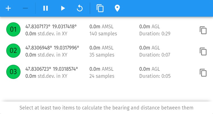
Use the icons on the dialog window’s toolbar to add/remove drones to/from the averaging list, pause, resume or restart the coordinate averaging, copy averaged coordinates to clipboard or to map origin.
If you select multiple drones for averaging, you can also read the distance and bearing between them automatically at the bottom of the window.